Restoring sloping wildflower meadow
Conservation work
Location
Date and time
11:00 - 12:00
Sunday, 12th of October 2025
Who this task will support
Royate Hill
The railway embankment creates a varied local topography with long and short, steep and gentle slopes. The habitats on the site range from limestone flora on the embankment top, to flower rich grassland, developing woodland and scrub on the embankment sides. Species such as ox-eyed daisy, mouse eared chickweed and bee orchid have been recorded at the site.
Hedgerows, a stream and an old orchard are also present within the reserve boundary.
The embankments were constructed in the early 1870's to form part of the Clifton Extension Railway. They span 450 metres in a shallow curve from Edward Street in the north west, to Clay Bottom to the east, crossing Royate Hill and the Coombe Brook at their centre.
The site was compulsorily purchased by the former Avon County Council in 1996, following a five-year high profile campaign by local people to save it from development.
Please note that this community mission has been cancelled.
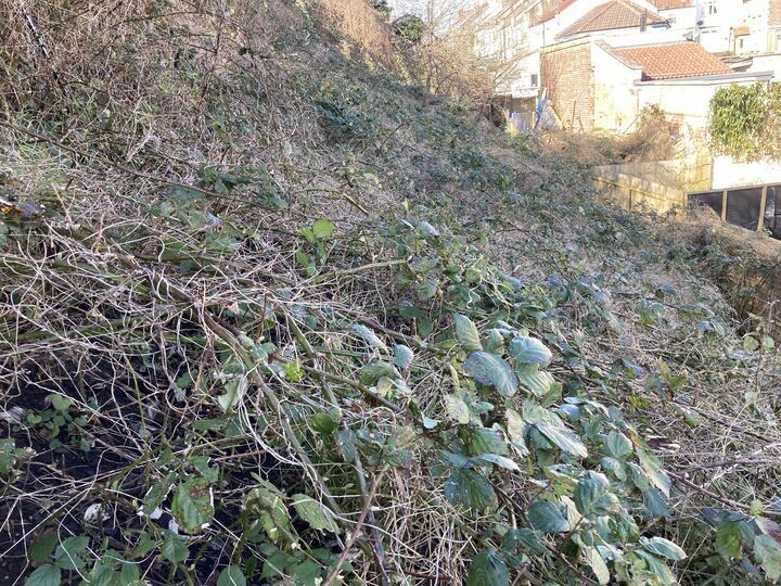
Cutting down of brambles on nature reserve embankment to 6 inches above the ground.
Robust footwear advised as embankment is steep and may also be slippery in places.
There is a rumour of yummy somosas afterwards :)
How are you getting there?
Discussion
Location
Date and time
11:00 - 12:00
Sunday, 12th of October 2025
Who this task will support
Royate Hill
The railway embankment creates a varied local topography with long and short, steep and gentle slopes. The habitats on the site range from limestone flora on the embankment top, to flower rich grassland, developing woodland and scrub on the embankment sides. Species such as ox-eyed daisy, mouse eared chickweed and bee orchid have been recorded at the site.
Hedgerows, a stream and an old orchard are also present within the reserve boundary.
The embankments were constructed in the early 1870's to form part of the Clifton Extension Railway. They span 450 metres in a shallow curve from Edward Street in the north west, to Clay Bottom to the east, crossing Royate Hill and the Coombe Brook at their centre.
The site was compulsorily purchased by the former Avon County Council in 1996, following a five-year high profile campaign by local people to save it from development.
Walkable
As you will make your own way to the task, feel free to walk or run as you wish.
Ideal for beginners
Opposite 45 Royate Hill
Bristol
BS5 6LP
Led by Richard Giddings
Rule 32: Enjoy the little things.
[This comment has been deleted]
Needed more people than just me. Will hopefully incorporate the task in a later volunteer day.
sign in to add a comment